01 · PLACE

GEOLOGYCOMPASS BEST SELLER · STRUCTURAL FIELDWORK
listerCompass
A stereographic field compass designed by a structural geologist. Measure a foliation and lineation together, see their geometry on a stereonet, attach a description and location, then preserve the observation in a data file or on a map.
MEASURESPlanes + lines
Foliations, surfaces and lineations—separately or together.
READINGS20 per cycle
The display reports a mean and standard deviation.
LOCATIONLat–long + UTM
Record the observation with its place and time.
PRIVACYData not collected
Your field observations remain under your control.
THE CORE ACTION
Place. Freeze. Record.
02 · FREEZE
Let the reading settle.
Hold the phone steady, watch the ± values, and tap the stereonet to freeze the result. If the scatter is too large, measure again.03 · RECORD
Double tap to keep it.
Double tap the stereonet to add the frozen orientation, time, coordinates and your current data description to the field log.FIELD WORKFLOW
From bare outcrop to a reusable record.
The app uses deliberate taps for field reliability. Read the prompt on the stereonet: one tap freezes a measurement; a double tap records it. Many settings also require a double tap so that they are less likely to change accidentally.
- 01
CHOOSE
Select what you are measuring.
Choose a surface, a lineation, or S+L for both. Select an orientation notation and either latitude–longitude or UTM coordinates before the traverse if you want a consistent log.
- 02
ALIGN
Place the phone on the feature.
For a plane, any direction on the surface is valid. When measuring a line on a plane, rotate the phone until its long axis is parallel to the lineation.
- 03
STABILISE
Watch the uncertainty.
Keep the device still while the display averages 20 readings. The ± values are the immediate check: large scatter is a reason to steady the phone or repeat the measurement.
- 04
CAPTURE
Tap, check, then double tap.
Tap the stereonet once to freeze the values. Check the result and its standard deviation, then double tap to record it. Add a short data description so the number keeps its geological meaning.
- 05
REVIEW
Inspect, map and export.
Review the measurement timeline in Data, place or annotate pins in Map, and save or share the record. KML placemarks can be opened in compatible mapping software, including Google Earth.
THE FOUR SCREENS
Measure, locate, review and configure.
The tab bar keeps the field workflow in four views. Return to Compass whenever you are ready for the next observation.
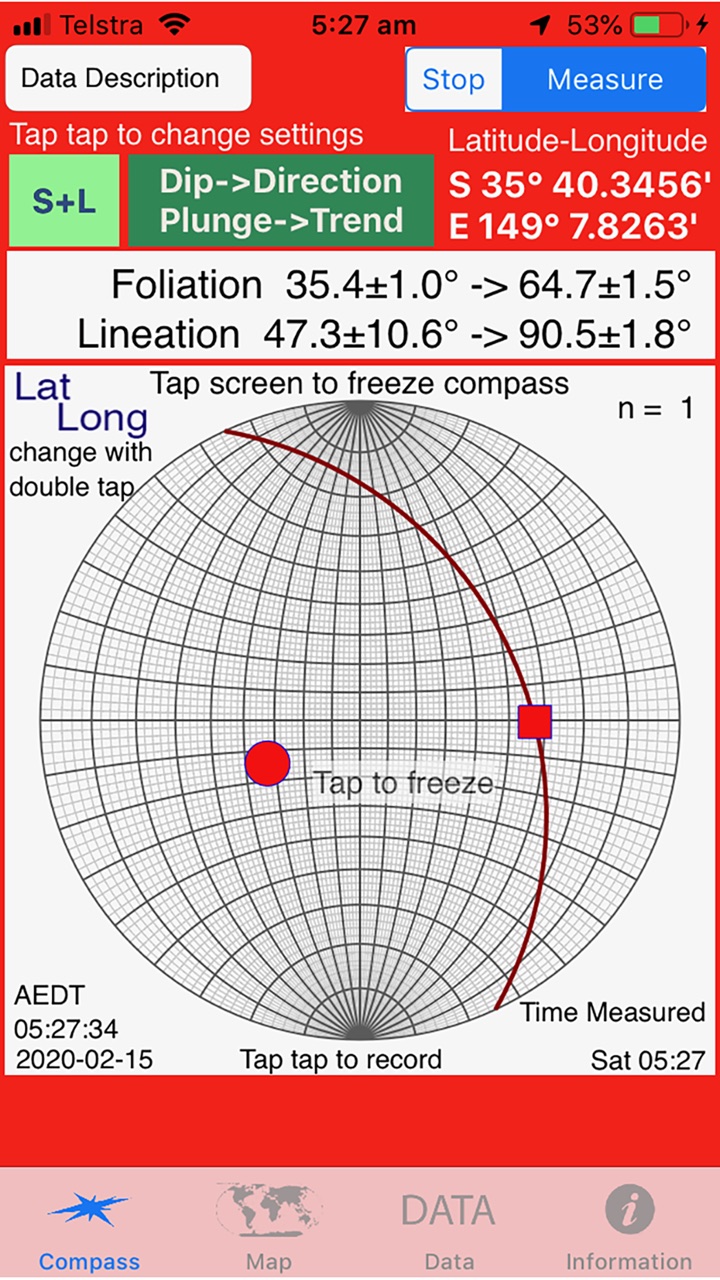
Choose the mode and notation, freeze the averaged result, then record it.
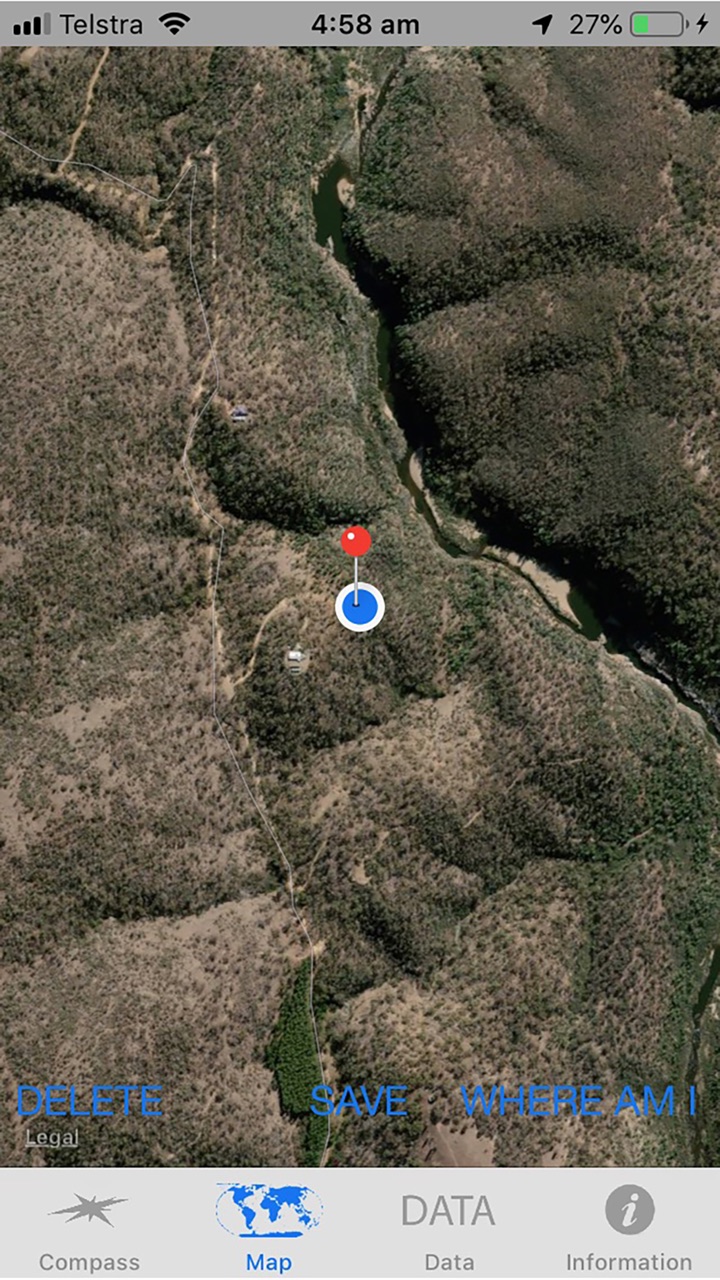
See your location, add a pin, annotate it, and prepare placemarks for export.
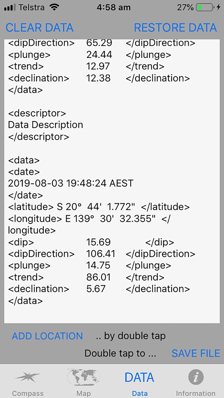
Inspect recorded observations, restore saved data, choose a file name and export.
Choose coordinate and orientation formats, time stamps and saving behaviour. Lock the settings before fieldwork so pocket taps do not alter the measurement convention midway through a traverse.
- NORTH
- Measurements are displayed relative to true north.
- ACTIONS
- Double-tap controls protect against accidental changes.
- FILES
- Field data can be saved and shared from the device.
READ THE NUMBERS YOUR WAY
One observation, several geological notations.
Strike · dip · rake
Strike is reported so the plane dips to its right. Rake describes the lineation within that plane.
Yaw · pitch · roll
Yaw is the trend of the lineation; pitch is its plunge. Roll relates the measured surface to the line.
Dip direction or quadrant
Use dip→direction and plunge→trend, or a strike–quadrant–dip form that echoes familiar field compasses.
Keep the guide beside your field kit.
This page covers the current field sequence. The archived guides add definitions and earlier screen-by-screen instructions.
APP STORE
Get listerCompass
Open the direct listing for current availability, compatibility and purchase information.
View listerCompass →FIELD NOTES
Orientation definitions
Read the original notes for strike–dip–rake, yaw–pitch–roll and field placement.
Read the notes →ARCHIVE · VERSION 5
Earlier screen guide
Consult the illustrated version 5 guide for the compass, data-list and map views.
Open the archive →